Charts age every week: how not to miss a critical correction
Why a freshly downloaded chart doesn't mean it's up to date, what a critical correction is, how to check your area in fifteen minutes before departure, and how an electronic chart differs from a paper one.
A chart is never "new". It's corrected as of a certain date — and starts going out of date from that day.
The UK Hydrographic Office issues Notices to Mariners weekly. So a chart downloaded a month ago has missed four issues. Among them could be a relocated buoy, a changed fairway, or a newly discovered shoal.
What a critical correction is
Hydrographers grade changes by importance. Critical ones are those that create a possible danger to navigation and require the fastest possible notice to mariners.
In practice this means:
- a discovered shoal, bank, or sunken object;
- a relocated or removed navigation mark;
- changed fairway boundaries;
- new restricted areas;
- a change in a lighthouse's light characteristics.
Everything else — refinements to depths, names, administrative boundaries — can wait. Critical cannot.
Fifteen minutes before departure
A routine worth turning into a habit.
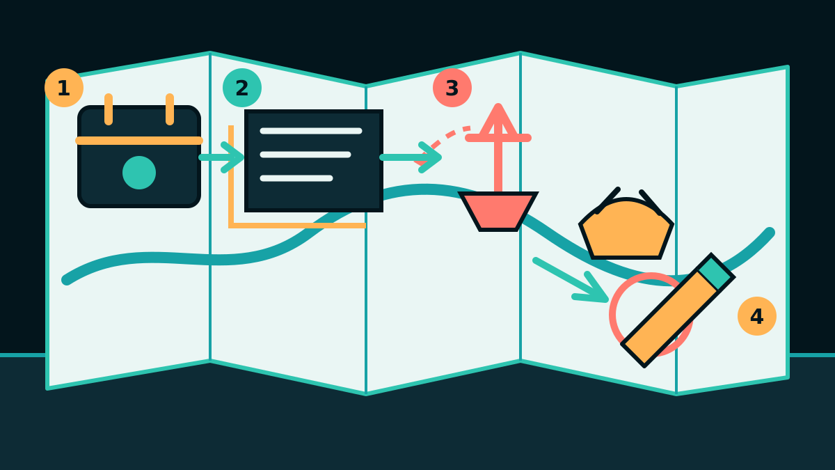
- Check the date of the last correction on your chart or chartplotter's firmware. It's always there: on a paper chart, at the bottom of the sheet; on an electronic one, in the chart information.
- Open the notices for the period from that date to today.
- Filter by your area. Don't look at everything — look at your route and ports of call.
- Check local notices separately for the port or country: they're issued more often and contain things that haven't reached the general notices yet.
- Plot the critical ones on paper, or check that they're in your device.
Fifteen minutes before a passage. Less time than it takes to refuel.
An electronic chart doesn't solve the problem
A common misconception: I have a plotter, it updates itself.
The device updates, not the sea. And here's what matters:
- The subscription may have expired. The plotter still works and still shows a chart — just an old one. Check the date, not whether a chart is present.
- The update has to be downloaded and installed. Many devices announce an available update once and don't remind you again.
- Notices are issued more often than chart updates. Time passes between a correction's release and its appearance on your plotter.
- A phone app has its own schedule and its own sources, and these can differ from the device.
Hence the rule: the date of correction, not the presence of a chart. Ask yourself not "do I have a chart" but "as of what date is it corrected."
What most often turns out to be outdated
From experience in areas where charter yachts sail:
- Buoys after winter storms. Torn away and relocated marks are the most common issue.
- Depths on approaches to marinas after dredging or silting.
- New fish farms and wind farms — in the Mediterranean and North Sea, more appear every year.
- Temporary restricted areas during works or exercises.
Paper alongside the device
Separately, on a point that's often debated: is a paper chart needed if you have a plotter.
The practical answer: you need one overview chart of the area on paper — not for navigation, but in case of a power failure, and as a way to see the whole passage at once, which a screen doesn't give you. And it's worth marking critical corrections on it: that also forces you to actually read them.
In short
A chart isn't "new" — it's corrected as of a date, and it starts aging from that day. Notices are issued every week. Before departure, check the correction date of your chart, read the notices for your area covering the time since then, and plot the critical ones. Fifteen minutes, which cost far less than any encounter with a shoal that isn't on your chart yet.